Ira Springs Trail WA
Share
Today’s Trail: Lake Mason
If you’ve ever sat in Seattle traffic wishing you could trade pavement for pine needles, this is your trail. Less than an hour east of the city, I-90 unwinds into mountains, the skyline shrinking in the rearview as you trade coffee shops for evergreen walls. By the time you pass North Bend, the air feels different — cooler, sharper, carrying that promise that the Cascades are about to open up.
Just past Snoqualmie Pass, you’ll take the turn for Exit 45. A forest road (gravel but friendly for any car) leads you higher until the trees close in and the trailhead appears. There’s a kiosk, a vault toilet, and the hum of other hikers getting their packs ready. You’ll need a Northwest Forest Pass here — you can buy a day pass at the machine, but most folks just grab the annual ahead of time at REI.
From here, the story shifts from highway noise to trail crunch.
The Hike Itself
The Ira Spring Trail starts gently, giving you a chance to find your pace under tall Douglas firs. The air is damp and earthy, the kind of forest that feels alive in layers: birds overhead, ferns at your ankles, roots crisscrossing the soil. For about a mile and a half, it’s friendly — a steady incline, wide tread, the kind of section where conversations happen easily.
Then the trail changes its tone. The incline sharpens, switchbacks appear, and the climb begins in earnest. It’s never cruel, just consistent — a stair-step rhythm that wakes up your legs. Natural pullouts along the way are perfect for catching your breath, taking a sip, or letting a faster group glide by with a cheerful “morning!”
As the trees thin, you step out onto a talus slope. Here the trailbuilders have laid stone steps, carrying you across a hillside of sun-warmed rock. Look left: a sweep of valley views stretches back toward Snoqualmie Pass. Look up: peaks you didn’t realize were so close frame the sky. This is the trail’s first big “wow” moment.
Climbing higher, you crest the ridge — the high point of the day at just over 4,300 feet. The world feels wider here, air moving more freely, Cascade ridgelines stacked like cutouts in the distance. Then, as quickly as it opened, the trail dips down, threading back into forest before spilling you out at Mason Lake.
Mason Lake
The first glimpse is a tease through the trees, sunlight bouncing off water. A few more steps and you’re there: a broad, rocky shoreline, glass-clear water, and conifers mirrored on the surface. Drift logs line the edge, perfect for sitting while you unpack lunch or just let your heart rate slow.

If you’re bold (or it’s one of those rare warm PNW days), wade in. The lake is alpine-cold, enough to shock you awake, but it’s also unforgettable. Bring sandals if you plan to swim — the rocks underfoot are no joke.
Stay as long as you like. This can be your finish line and it will still be a day to brag about.
Bonus: Little Bandera Spur
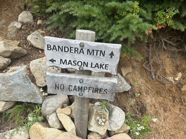
If your legs still have fuel, backtrack to the Bandera Mountain junction and climb the short, steeper Little Bandera Spur. It’s rocky, about 0.6 miles, and adds ~700 feet of gain in a hurry. The payoff is big views — a panorama that includes Rainier on clear days. But don’t feel pressured; Mason Lake itself is more than enough.

Quick Facts
- Distance / Gain: ~7 miles round-trip to Mason Lake, ~2,400 ft gain
- Trailhead: Ira Spring Trailhead, I-90 Exit 45 (road is dirt but passable for all cars)
- Pass Required: Northwest Forest Pass (day machine here; annual is easiest)
- Dogs: Allowed on leash — lots of friendly pups out there
- Start Tip: Begin by 9:00 a.m. for parking, cooler temps, and less rush
Trail Notes for First-Timers
- Bring 2 liters of water if it’s warm — no treated water at the trailhead.
- Poles are a knee-saver on the descent.
- Stay on the main dirt tread in rocky sections; don’t be tempted by side paths.
- Pack sandals if you plan to swim — rocky lake edge.
- Keep dogs leashed and pack out everything. Trail karma matters.
Not in the PNW? “Mason Lake-Energy” Hikes Around the U.S.
Similar effort profile: 4–9 miles round-trip, ~1,000–2,700 ft gain, clear tread, and a lake or big viewpoint at the end. Always check local conditions.
-
Herman Lake (Herman Gulch), Colorado – Front Range
~6.5–7.2 mi RT, ~1,650–1,800 ft gain. Wildflowers, steady grade, alpine lake; altitude is the X-factor. USFS lists the trail to Herman Lake on the CDT; distances/gain vary slightly by source. US Forest ServiceAllTrails.comThe Colorado Mountain Club -
Black Elk Peak (Trail 9 from Sylvan Lake), South Dakota – Black Hills
~6.4–7.0 mi RT, ~1,500 ft gain. Granite spires, historic fire tower, huge views from South Dakota’s high point. (State park area access rules apply near Sylvan.) Highpoint GuideTravel South Dakota -
Looking Glass Rock, North Carolina – Pisgah National Forest
~6.2–6.5 mi RT, ~1,600–1,700 ft gain. Switchbacks to a broad granite balcony over the Blue Ridge. Official USFS page lists 3.1 mi one way with steady climbing. US Forest ServiceExplore Asheville -
Lonesome Lake, New Hampshire – Franconia Notch
~3.0–3.2 mi RT/loop, ~1,000 ft gain. Short, steady, family-friendly climb to a classic hut-side lake. Appalachian Mountain Club (AMC)AllTrails.com -
Cathedral Lakes, California – Yosemite (Tuolumne Meadows)
~7.0 mi RT to Upper Cathedral; ~8–9+ mi RT if you visit both lakes. ~1,000–1,650 ft gain. Gentle grade, big granite drama. (No dogs; park rules apply.) National Park ServiceYosemite Hikes -
Williams Lake, New Mexico – Taos Ski Valley (Wheeler Peak Wilderness)
~4.0–4.2 mi RT, ~900–1,000 ft gain. Shorter day with honest climbing to an alpine bowl; altitude adds effort. AllTrails.comTrailforks


